During our hikes through Yosemite this summer, the one thing that always stood out were the spectacular vistas. It was nearly impossible to get a sense of the scenery in a single camera view.
To try and give you a sense of the visuals, I have combined panning shots of several scenes into long panoramas.
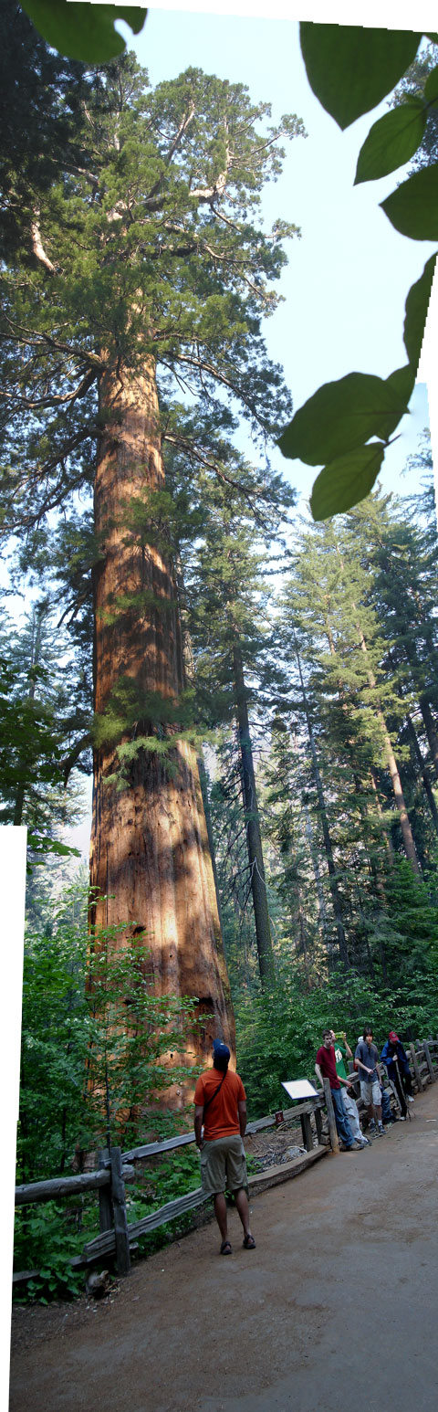
Some of the panoramas are vertical, like this long view to the top of a sequoia. All of the trees in the park are large, but the Giant Sequoias are just jumbo-humongo. Once they reach their max height of about 300', like this one, they just keep getting wider. This one is about 30' across at the base.
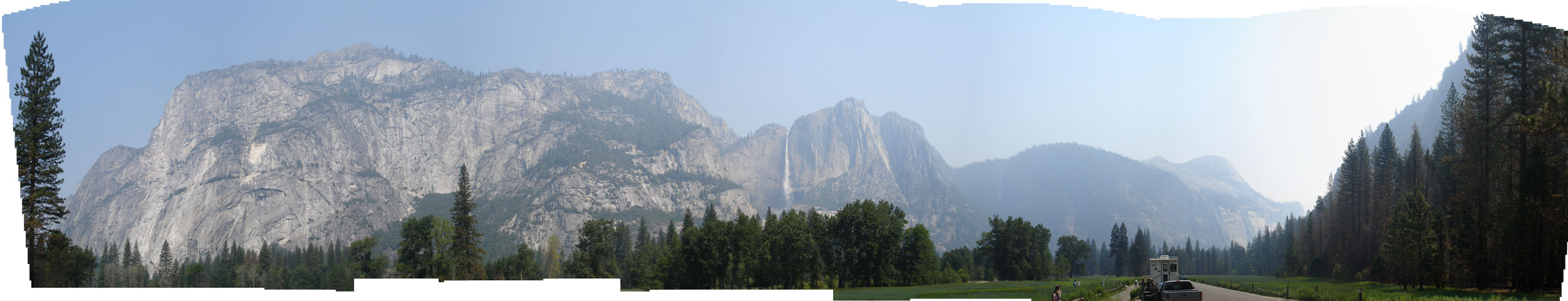
This is a view from mid-valley to the North, with El Cap on the left, over to Yosemite Falls in the middle. Everywhere you look in the valley, it’s just one more thousand foot cliff with a waterfall coming over it.
This picture is a bit hazy. There were fires just west of the park, and the smoke had a huge impact on the views earlier in the week.
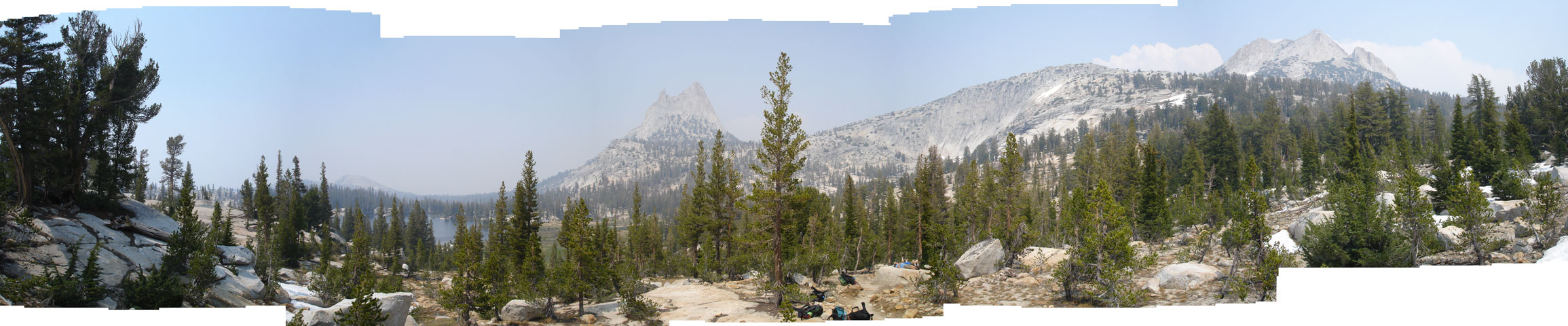
This view is from just below Cathredal Pass looking east. This was near the end of our first day on the John Muir trail. We started on the other side of Cathredal Peaks, which is the double-pointed mountain in the middle.
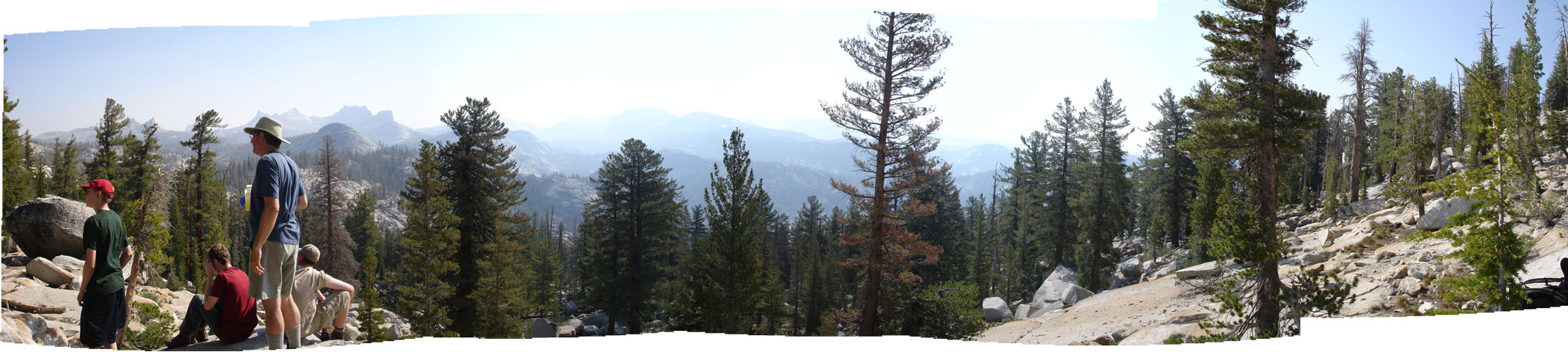
The trail skirts the south side of Tresidder Peak, and this is a view looking out over the valley. The guys are looking back down the trail we've been climbing.
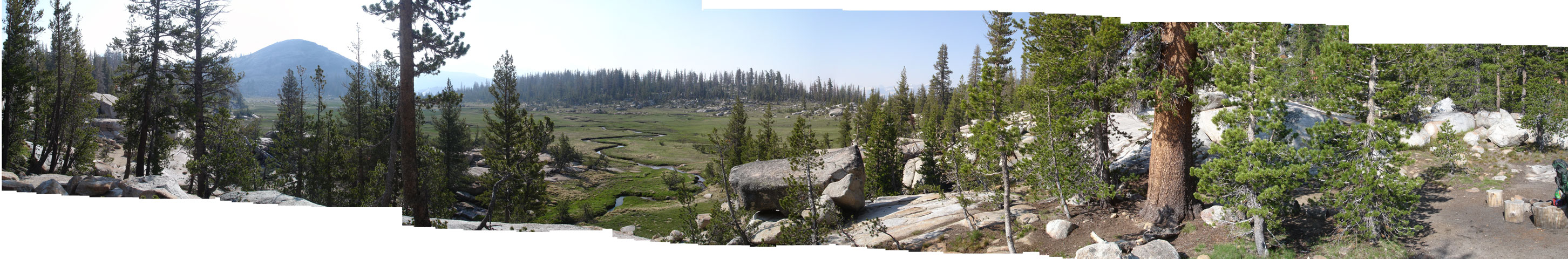
We spent our second night at Sunrise Camp. This was taken the next morning. The camp sits on a hillside of terraced boulders overlooking a meadow.
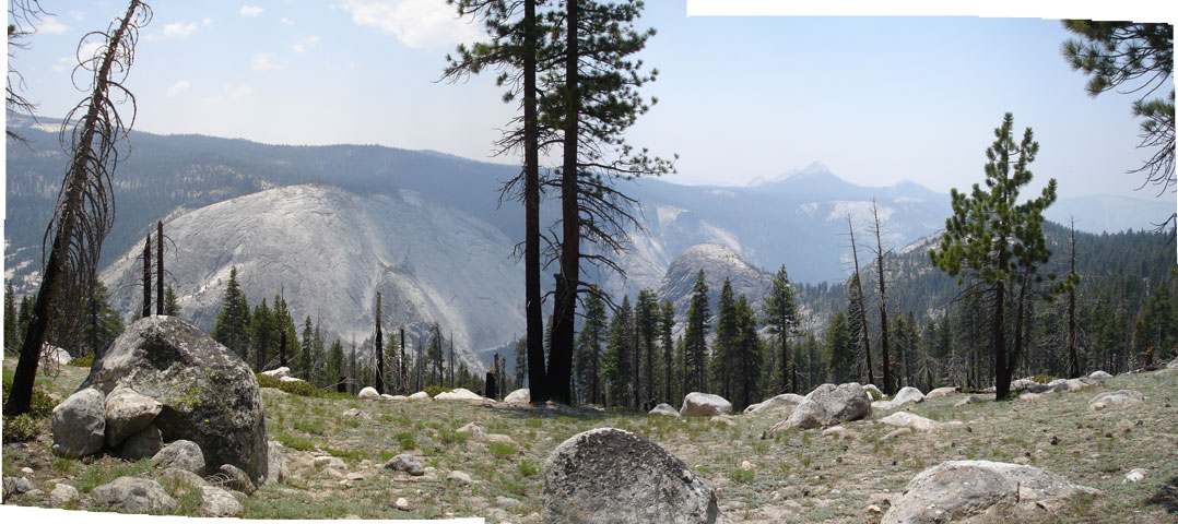
On the third day we hiked along a ridge overlooking the upper part of the Little Yosemite Valley.
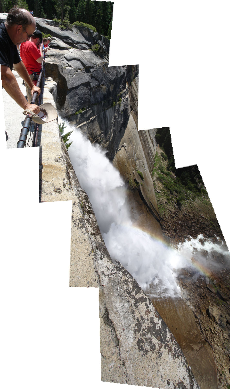
This was taken from the top of the cliff where Nevada Falls goes over the edge. It's nearly 600 feet to the bottom. That's actually three times higher than Niagara Falls. Even with the railing, it's a bit scary looking over the edge.
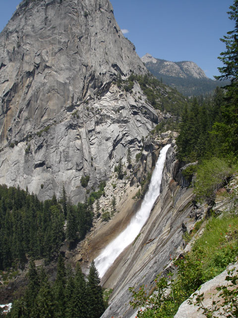
This view of Nevada Falls puts the height more in perspective. You can't even see the people standing at the railings. They're on the ledge just above the top of the falls. The trees at the bottom are over 100' feet tall. You also get a good view of the Mist Trail path as it ascends through the rock field to the left of the falls. You can get another view of these falls from the Glacier Point panorama below.
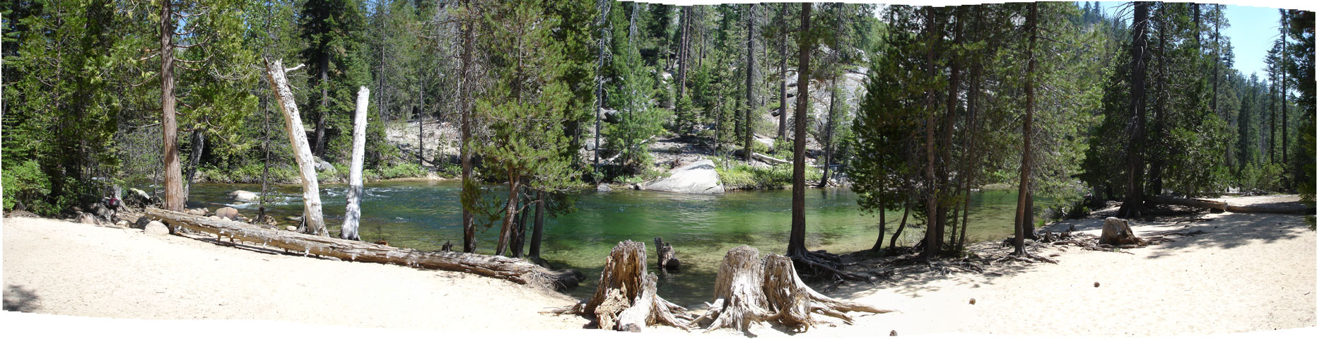
We spent three nights at the Little Yosemite Valley campground. The Merced river runs past the campground, and there is a spectacular beach there. This is a few miles upstream from Nevada Falls. The water is crystal clear and you can see all the way to the bottom easily. However, it is ice cold. The peculiar green color is from the algae in the snowmelt that feeds it.
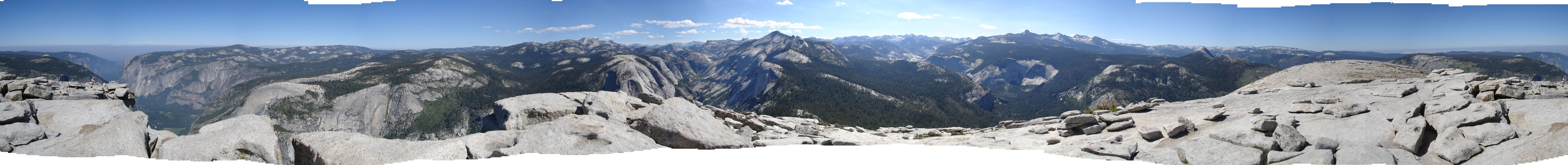
The high point of the trip was the climb to the top of Half Dome. This is a 360 degree view from the high point of the Dome. I'm standing about ten feet from the edge of the cliff, which is a 1500' sheer drop, and nearly 4000' above the valley floor.
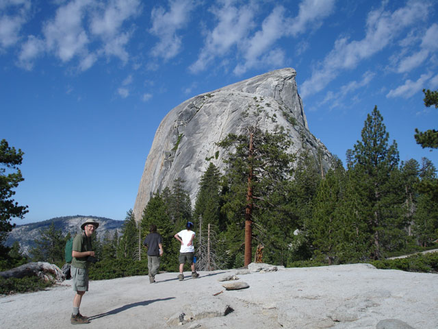
People keep asking me how you get to the top of Half Dome. There is a strenuous trail that goes up to the ridge east of Half Dome. After climbing a bit more you get to this spot, at the base of the 'shoulder'. You have to climb the ridge of the shoulder.
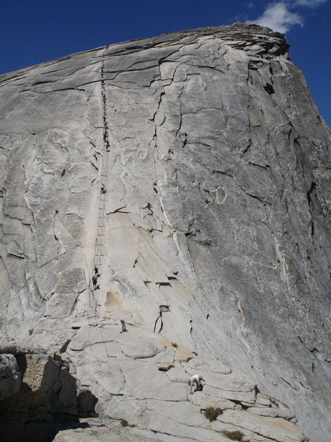
Once you get to the top of the shoulder, you have to climb the infamous 'cables'. The cables take you up the last 400' to the top. It's kind of like climbing a really steep stairway with the cables as handrails. But there are no stair treads, the cables are worn smooth and slippery, and at some points the cables are only knee high. The rock is so steep that if you look around it is disorienting. People have fallen to their deaths from this trail.
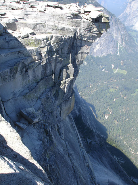
This is the view over the edge of the cliff. Keep in mind the wind was gusting to 30mph or so, over the cliff. I just held my camera over the edge.
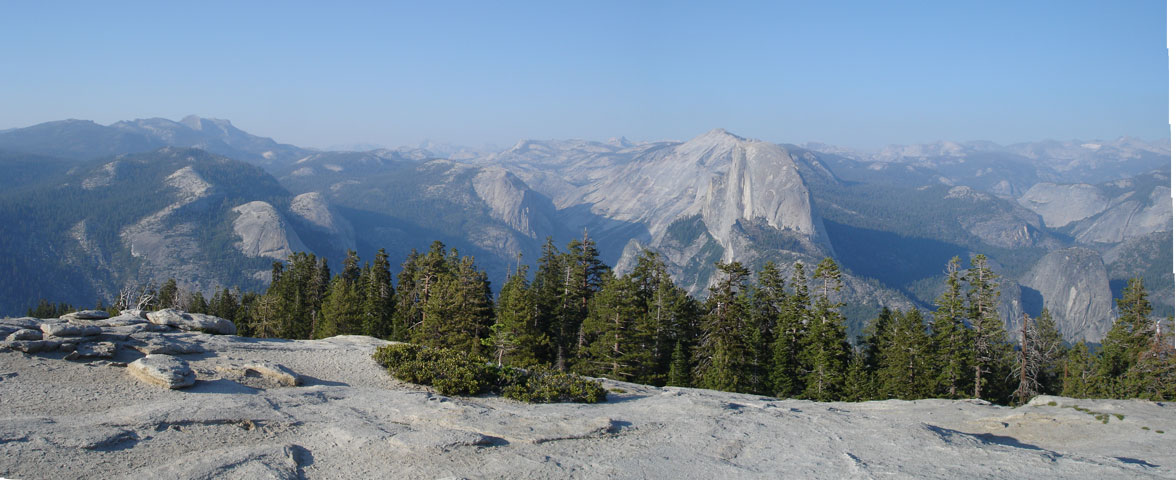
On our last full day in the park we drove around to the south rim and did an easy hike up to Sentinal Dome. This is the view looking east towards Half Dome.
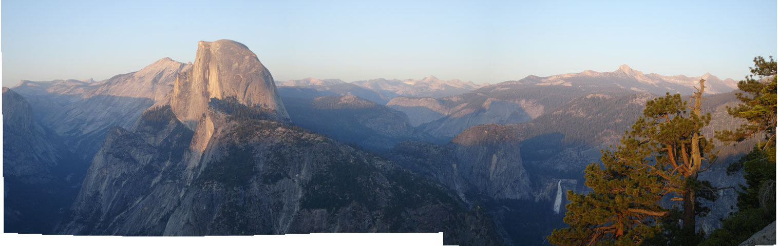
Just below Sentinal Dome is Glacier Point. This is at the top of a cliff on the south side of the valley. Again, looking east toward Half Dome, at sunset, with Nevada Falls on the right.
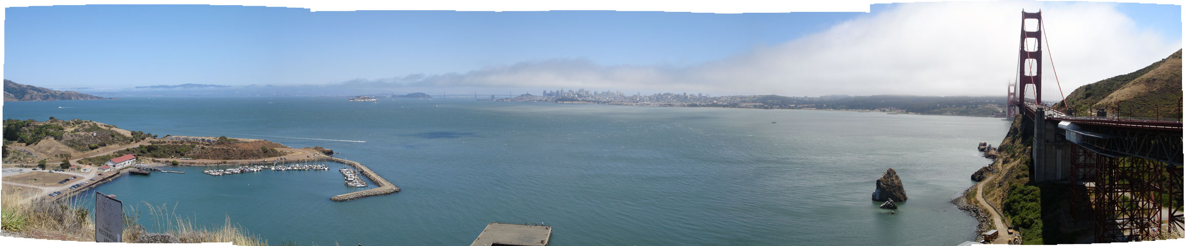
On our last day in California, we spent a few hours driving around San Francisco. This view is from the lookout on the north side of the Golden Gate Bridge. You can see the fog coming in beyond the bridge.
These panoramas were made with Photoshop Elements. It was amazingly easy once I figured out all the tricks, like freeing up enough memory and disk on my computer. Almost automagic. The rough edges on the pictures are because I did these freehand, and didn't use a tripod to keep my horizons level.